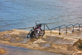
I Used A Canon 1DsMkIII
THE COASTAL AREA BETWEEN SEAPOINT AND BELGRAVE PLACE [CANON 1DsIII]
In March 2008 I explored the coastal areas between Blackrock an Dalkey using my problematic Canon 1DsIII camera. Later this month I plan to revisit and have yet to decide if I should use the old Canon. The programme begins in a few days as I plan to visit Dalkey.
The narrow coastal corridor stretching between Seapoint and Belgrave Place forms one of the most distinctive visual interfaces along south Dublin Bay. Sandwiched between the twin tracks of the Dublin and Kingstown railway line—now electrified for the DART—and the open expanse of the bay, this stretch captures an intriguing dialogue between heavy Victorian transport engineering, tidal mudflats, and granite sea walls.
The Coastal Trackside Interface
Running southeast from the slipways of Seapoint towards Salthill and Monkstown, the coastal footway hugs the railway line directly. Built along a raised granite embankment designed in the 1830s to claim passage across the foreshore, the trackside section is defined by:
Granite Retaining Walls and Balustrades: Sturdy, weathered Dalkey granite coping lines the seaward boundary, standing resilient against winter salt spray and storm tides.
Tidal Sands and Rocky Outcrops: At low tide, the sea recedes hundreds of metres across the bay flats, exposing ribbons of bladderwrack, weed-covered boulders, and shallow tide pools. At full tide, the water laps directly against the base of the track bed revetments.
Industrial and Naval Vistas: Looking northwards across the bay from the track perimeter reveals clear, panoramic sightlines to Poolbeg’s red-and-white generating chimneys, the North Bull Wall, and Howth Head. Turning slightly east frames the approaching granite arm of the West Pier at Dún Laoghaire Harbour.
The Martello Presence: Anchoring the northern end stands the squat, sturdy Seapoint Martello tower, perched on its rocky outcrop and overlooking the bathing place ramps.
Between the Stations
Moving between Seapoint Station and Salthill & Monkstown Station, the corridor shifts from exposed foreshore to a semi-sunken rail cutting. Cast-iron footbridges span overhead, offering sharp downward angles onto commuter trains gliding along the ballast, framed against the sea horizon beyond.
Along Belgrave Place and Belgrave Square East, grand Victorian terraces stand slightly elevated behind the line, their upper sash windows commanding unobstructed sea views over the catenary wires and embankment copings. The contrast here is palpable: the mechanical rhythm of passing trains on one side, counterbalanced by the crying gulls and rhythmic tide on the other.
The construction of the Dublin and Kingstown Railway (D&KR) past Seapoint and onward to Kingstown (now Dún Laoghaire) represents one of the earliest, most daring feats of coastal railway civil engineering in the world. Authorised by Parliament in 1831 and formally opened in December 1834, it was Ireland’s first commercial railway and the world’s first purpose-built suburban passenger line.
While the inner sections between Westland Row and Blackrock crossed low-lying marshes and reclaimed polders, the final push through Seapoint, Salthill, and Monkstown forced the engineers out onto the open foreshore of Dublin Bay.
The technical vision for the railway was steered by two towering figures of early nineteenth-century British and Irish civil engineering:
William Vignoles (Chief Engineer): Vignoles designed the route, established the gradients, and solved the unprecedented challenge of carrying heavy locomotive traffic over loose marine mud, tidal flats, and exposed coastal rock shelves. His innovative use of flat-bottomed rails (later known globally as the Vignoles rail) originated in this era.
Alexander Nimmo (Consulting Engineer): Prior to his death in 1832, Nimmo provided crucial marine engineering guidance, drawing on decades of experience surveying Irish harbours, bog roads, and coastal defences.
Thomas Macneill & William Dargan (Contractors): William Dargan, widely regarded as the father of Irish railways, oversaw major portions of the earthworks, masonry revetments, and trackbeds, cementing his reputation through the high standard of construction delivered under fierce tidal constraints.
Overcoming the Seapoint Foreshore
Between Blackrock and Kingstown, the railway company faced stubborn opposition from affluent coastal landowners who refused to allow the railway to carve through their private estates, lawns, and maritime villas. To circumvent these aristocratic estates at Monkstown and Seapoint, Vignoles made the bold decision to take the line seaward of the high-water mark.
This required building a continuous, heavy granite sea embankment directly into Dublin Bay:
The Marine Embankments: Engineers threw up massive earthen and rubble dykes directly across the tidal sands. These cores were armoured with outward-sloping walls of coursed Dalkey granite, pitched at an angle calculated to deflect and break incoming storm swells rather than absorb their blunt kinetic energy.
Hydraulic Lime & Roman Cement: To bind the submerged seawall foundations before the incoming tide drowned the works, Dargan’s stonemasons made extensive use of hydraulic limes and fast-setting Roman cement that could cure underwater.
Culverts and Tidal Sluices: Because the railway effectively cut off the natural drainage of small coastal streams and tidal inlets, engineers had to integrate stone-arched culverts beneath the track ballast. Heavy cast-iron flap-valves allowed landward run-off to exit at low tide while preventing seawater from surging back inland during high-water spring tides.
Navigating the Martello Outcrop and Salthill Cutting
At Seapoint, the rugged granite headland crowned by the 1804 British Martello Tower presented a formidable natural obstacle.
Rock Blasting: Navvies used black powder blasting to cut a ledge into the hard granite headland. The blasted granite spoil was immediately repurposed as heavy rip-rap ballast and foundation material for the adjacent sea revetments.
The Salthill Cutting: South of the Seapoint outcrop, the alignment transitioned into a deep, steep-sided rock cutting fronting Salthill. Vignoles bridged this chasm with elegant, single-span masonry arch bridges and decorative cast-iron footbridges, preserving pedestrian access from the terraces down to the shoreline bathing boxes.
Atmospheric Railway Experiment (1844–1854):
Though the initial D&KR line ended at Kingstown Harbour, the subsequent extension to Dalkey via the adjacent coastal cuttings served as the world’s first commercial atmospheric railway, using stationary steam-driven vacuum pumps and piston-fitted carriages running over track-centre cast-iron tubes.
Engineering Legacy along the Shoreline
The granite sea ramparts built by Vignoles and Dargan along the Seapoint trackside were engineered with such precision that they survived the fierce Irish Sea gales of nearly two centuries virtually intact. When the line was electrified for the modern DART network in the early 1980s, the Victorian sub-base and stone retaining structures required only modest underpinning to support the overhead steel masts and high-frequency electric commuter sets in service today.
In March 2008 I explored the coastal areas between Blackrock an Dalkey using my problematic Canon 1DsIII camera. Later this month I plan to revisit and have yet to decide if I should use the old Canon. The programme begins in a few days as I plan to visit Dalkey.
The narrow coastal corridor stretching between Seapoint and Belgrave Place forms one of the most distinctive visual interfaces along south Dublin Bay. Sandwiched between the twin tracks of the Dublin and Kingstown railway line—now electrified for the DART—and the open expanse of the bay, this stretch captures an intriguing dialogue between heavy Victorian transport engineering, tidal mudflats, and granite sea walls.
The Coastal Trackside Interface
Running southeast from the slipways of Seapoint towards Salthill and Monkstown, the coastal footway hugs the railway line directly. Built along a raised granite embankment designed in the 1830s to claim passage across the foreshore, the trackside section is defined by:
Granite Retaining Walls and Balustrades: Sturdy, weathered Dalkey granite coping lines the seaward boundary, standing resilient against winter salt spray and storm tides.
Tidal Sands and Rocky Outcrops: At low tide, the sea recedes hundreds of metres across the bay flats, exposing ribbons of bladderwrack, weed-covered boulders, and shallow tide pools. At full tide, the water laps directly against the base of the track bed revetments.
Industrial and Naval Vistas: Looking northwards across the bay from the track perimeter reveals clear, panoramic sightlines to Poolbeg’s red-and-white generating chimneys, the North Bull Wall, and Howth Head. Turning slightly east frames the approaching granite arm of the West Pier at Dún Laoghaire Harbour.
The Martello Presence: Anchoring the northern end stands the squat, sturdy Seapoint Martello tower, perched on its rocky outcrop and overlooking the bathing place ramps.
Between the Stations
Moving between Seapoint Station and Salthill & Monkstown Station, the corridor shifts from exposed foreshore to a semi-sunken rail cutting. Cast-iron footbridges span overhead, offering sharp downward angles onto commuter trains gliding along the ballast, framed against the sea horizon beyond.
Along Belgrave Place and Belgrave Square East, grand Victorian terraces stand slightly elevated behind the line, their upper sash windows commanding unobstructed sea views over the catenary wires and embankment copings. The contrast here is palpable: the mechanical rhythm of passing trains on one side, counterbalanced by the crying gulls and rhythmic tide on the other.
The construction of the Dublin and Kingstown Railway (D&KR) past Seapoint and onward to Kingstown (now Dún Laoghaire) represents one of the earliest, most daring feats of coastal railway civil engineering in the world. Authorised by Parliament in 1831 and formally opened in December 1834, it was Ireland’s first commercial railway and the world’s first purpose-built suburban passenger line.
While the inner sections between Westland Row and Blackrock crossed low-lying marshes and reclaimed polders, the final push through Seapoint, Salthill, and Monkstown forced the engineers out onto the open foreshore of Dublin Bay.
The technical vision for the railway was steered by two towering figures of early nineteenth-century British and Irish civil engineering:
William Vignoles (Chief Engineer): Vignoles designed the route, established the gradients, and solved the unprecedented challenge of carrying heavy locomotive traffic over loose marine mud, tidal flats, and exposed coastal rock shelves. His innovative use of flat-bottomed rails (later known globally as the Vignoles rail) originated in this era.
Alexander Nimmo (Consulting Engineer): Prior to his death in 1832, Nimmo provided crucial marine engineering guidance, drawing on decades of experience surveying Irish harbours, bog roads, and coastal defences.
Thomas Macneill & William Dargan (Contractors): William Dargan, widely regarded as the father of Irish railways, oversaw major portions of the earthworks, masonry revetments, and trackbeds, cementing his reputation through the high standard of construction delivered under fierce tidal constraints.
Overcoming the Seapoint Foreshore
Between Blackrock and Kingstown, the railway company faced stubborn opposition from affluent coastal landowners who refused to allow the railway to carve through their private estates, lawns, and maritime villas. To circumvent these aristocratic estates at Monkstown and Seapoint, Vignoles made the bold decision to take the line seaward of the high-water mark.
This required building a continuous, heavy granite sea embankment directly into Dublin Bay:
The Marine Embankments: Engineers threw up massive earthen and rubble dykes directly across the tidal sands. These cores were armoured with outward-sloping walls of coursed Dalkey granite, pitched at an angle calculated to deflect and break incoming storm swells rather than absorb their blunt kinetic energy.
Hydraulic Lime & Roman Cement: To bind the submerged seawall foundations before the incoming tide drowned the works, Dargan’s stonemasons made extensive use of hydraulic limes and fast-setting Roman cement that could cure underwater.
Culverts and Tidal Sluices: Because the railway effectively cut off the natural drainage of small coastal streams and tidal inlets, engineers had to integrate stone-arched culverts beneath the track ballast. Heavy cast-iron flap-valves allowed landward run-off to exit at low tide while preventing seawater from surging back inland during high-water spring tides.
Navigating the Martello Outcrop and Salthill Cutting
At Seapoint, the rugged granite headland crowned by the 1804 British Martello Tower presented a formidable natural obstacle.
Rock Blasting: Navvies used black powder blasting to cut a ledge into the hard granite headland. The blasted granite spoil was immediately repurposed as heavy rip-rap ballast and foundation material for the adjacent sea revetments.
The Salthill Cutting: South of the Seapoint outcrop, the alignment transitioned into a deep, steep-sided rock cutting fronting Salthill. Vignoles bridged this chasm with elegant, single-span masonry arch bridges and decorative cast-iron footbridges, preserving pedestrian access from the terraces down to the shoreline bathing boxes.
Atmospheric Railway Experiment (1844–1854):
Though the initial D&KR line ended at Kingstown Harbour, the subsequent extension to Dalkey via the adjacent coastal cuttings served as the world’s first commercial atmospheric railway, using stationary steam-driven vacuum pumps and piston-fitted carriages running over track-centre cast-iron tubes.
Engineering Legacy along the Shoreline
The granite sea ramparts built by Vignoles and Dargan along the Seapoint trackside were engineered with such precision that they survived the fierce Irish Sea gales of nearly two centuries virtually intact. When the line was electrified for the modern DART network in the early 1980s, the Victorian sub-base and stone retaining structures required only modest underpinning to support the overhead steel masts and high-frequency electric commuter sets in service today.


SEAPOINT MARCH 2008